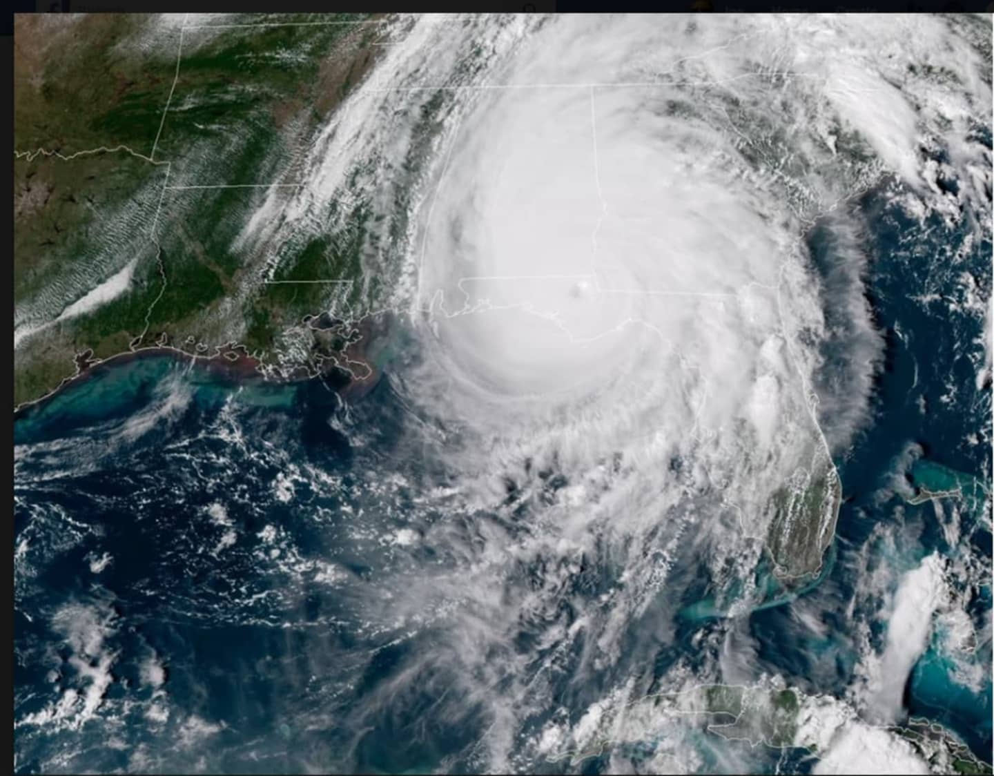

Michael was just two miles per hour short of Category 5 status of 157 mph winds at landfall, making it the strongest storm to make landfall in the continental U.S. since Hurricane Andrew in 1992.
Hours after landfall, Michael became a Category 3 hurricane with 125 mph winds as its track shifted easterly toward Alabama and Georgia.
While the storm will be well south of the tristate area as it moves toward the coast on Thursday, it will bring drenching rain and possible thunderstorms.
A Flash Flood Watch has been issued for all of Eastern New York and Western New England from Thursday morning through late Thursday night.
Bands of showers and isolated thunderstorms, some with locally heavy downpours, will move across the area ahead of an approaching cold front as tropical moisture moves into the region.
A widespread 1 to 2 inches rainfall is expected, but rainfall rates as high as up to an inch an hour are possible.
Flash flooding is possible especially in low lying and poor drainage areas as well as creeks, brooks, and small streams as water levels are running above normal.
Any heavy rainfall that occurs within a one- to three-hour window may result in flash flooding.
Check back to Daily Voice for updates.
Click here to follow Daily Voice Armonk and receive free news updates.