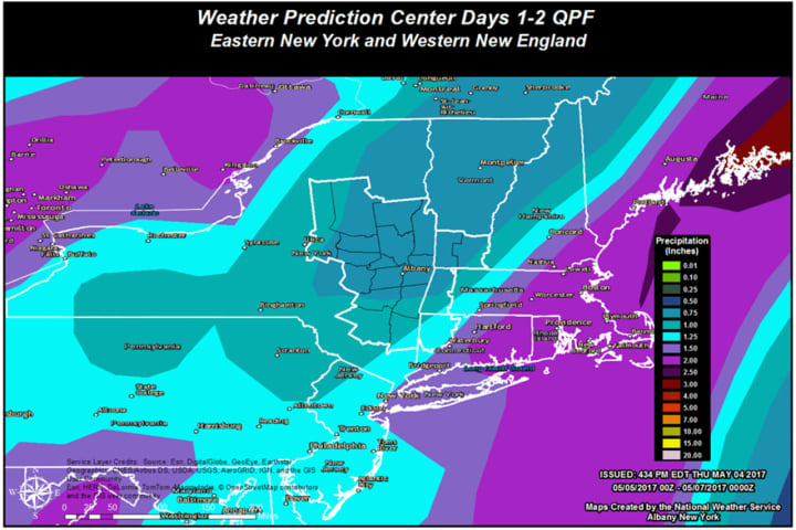
Rain is expected to start sometime in the predawn hours Friday with rainfall amounts through Saturday expected to generally be around 0.75 to 1.50 inches, with the greater amounts south, according to the National Weather Service. (See image above.)
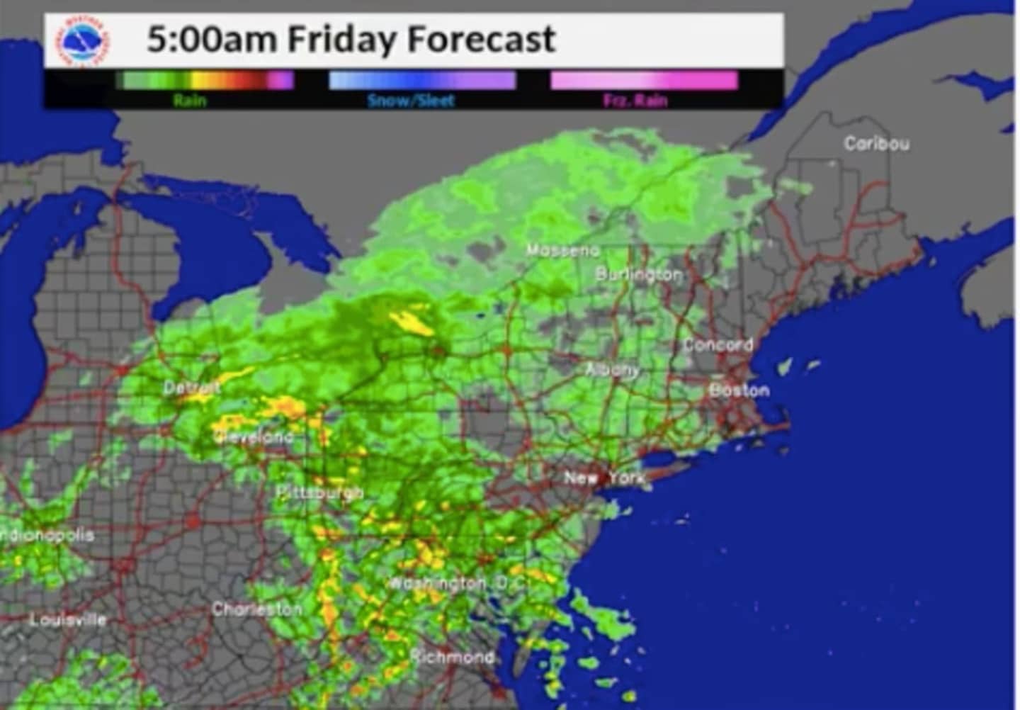
Steady rain kicks in at the tail end of the Friday morning commute, at around 8 a.m., and will remain heavy through around 3 p.m., accompanied by gusty winds. (See projected radar image above)
Thunderstorms are possible after 9 a.m. Friday. Some of the storms could produce heavy rainfall.
There will be areas of fog after 11 a.m.
Friday's high will be in the upper 50s.
Rain will continue Friday night, with more thunderstorms possible before midnight, followed by more rain between midnight and 3 a.m. Saturday and showers after 3 a.m.
The rest of the day Saturday will be mostly cloudy with a high temperature will be in the low 60s.
There is a 30 percent chance of showers on Sunday, otherwise it will be partly sunny with a high near 60. Sunday night will be mostly cloudy and colder, with a low around 40.
The colder air will continue as the workweek starts Monday, with the high struggling to climb out of the low 50s under partly cloudy skies.
Check back to Daily Voice for updates.
Click here to follow Daily Voice Armonk and receive free news updates.