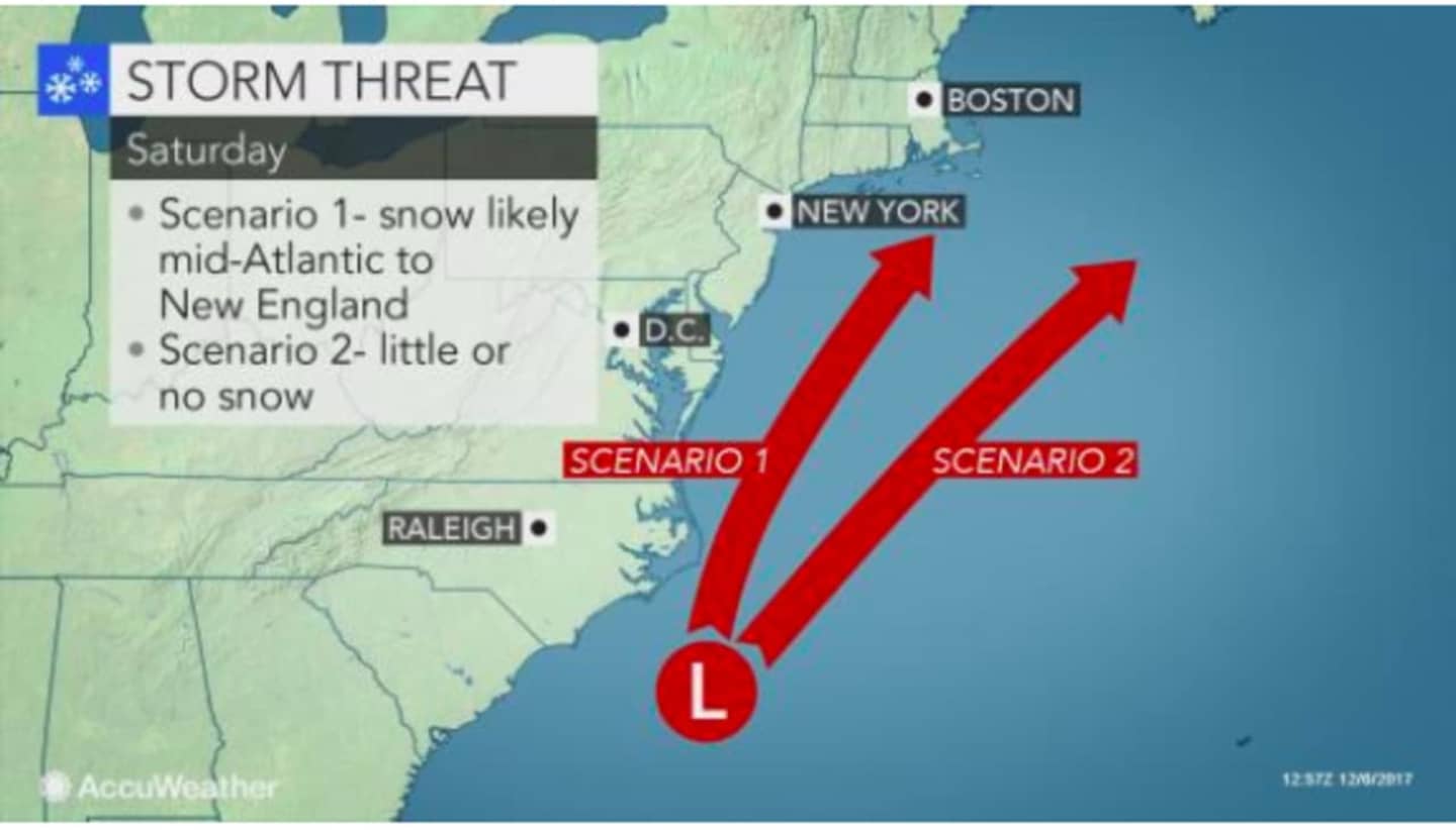
How close to the coast the storm tracks will determine where snow versus flurries versus rain will occur, according to AccuWeather.com. If the system tracks closer to the coast, snow is likely. If its track is farther east over the Atlantic, little or snow is likely. (See image above.)
"At the very least, we believe there will be some sort of wintry precipitation in the Northeast," according to AccuWeather Chief Meteorologist Elliot Abrams. "A storm that tracks close to the coast and gains only a moderate amount of strength would be successful at bringing a stripe of accumulating snow from New York City to Boston and perhaps as far to the southwest at Philadelphia and Washington, D.C."
After a sunny day Thursday with a high in the mid-40s, Friday will be partly sunny with a high near 40.
The snow chance begins Friday night with the overnight low around 24 degrees. There is also a chance of snow through around 2 p.m. Saturday before the high temperature reaches the mid- to upper-30s.
Sunday will be partly sunny with a high in the mid-30s.
Check back to Daily Voice for updates on the storm and its track.
Click here to follow Daily Voice Armonk and receive free news updates.