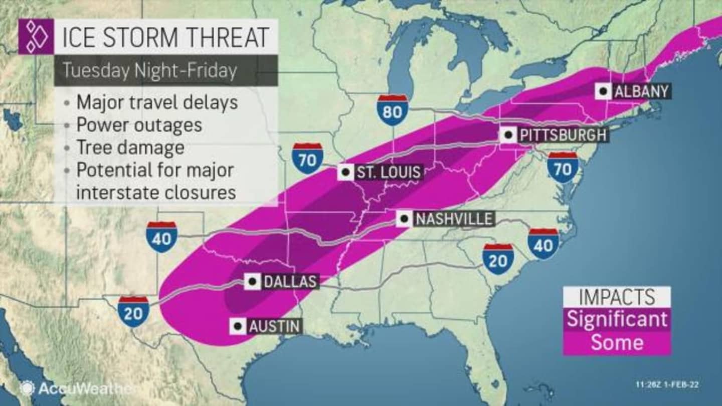

Not only will the storm impact around 90 million people, but also retailers and consumers, according to AccuWeather.com.
"We could be looking at a big mess in moving products to where people and businesses need them as a result of our latest winter storm, and this interruption in the supply chain may be felt for weeks," said AccuWeather Chief Meteorologist Jonathan Porter.
The storm will sweep through this region Thursday night, Feb. 3 through Friday, Feb. 4, as a cold front will move in with "quickly falling temperatures behind it," according to the National Weather Service.
"Rain Thursday night will change to a wintry mix from northwest to southeast, with several hours of freezing rain, sleet, and snow," the weather service said in a Hazardous Weather Outlook statement. "This will lead to ice accretion on any untreated surfaces, making travel hazardous potentially for both the morning and evening commutes on Friday.
"Additionally, any standing water from rainfall and melting snow will freeze, exacerbating these conditions."
But first, Wednesday, Feb. 2 is Groundhog Day, and down in Pennsylvania, the so-called "prognosticator of prognosticators," Punxsutawney Phil, saw his shadow just before 7:30 a.m., meaning we're in for six more weeks of winter.
Wednesday will be mostly cloudy with the high temperature climbing to 40 degrees, according to the National Weather Service.
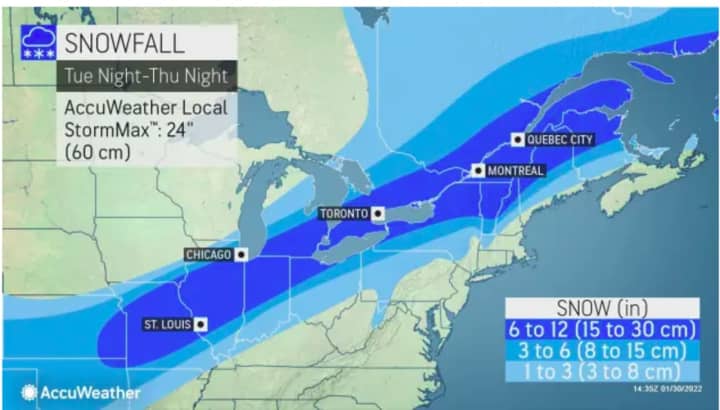
This region will see precipitation arriving mainly as scattered showers in the early morning hours on Thursday, the National Weather Service says. More steady rain is likely Thursday afternoon and continuing through the evening.
The temperature will fall from a high of around 40 degrees on Friday into the upper 20s Friday afternoon, as rain will change to freezing rain, sleet and light snow. It's too early to predict potential snowfall amounts.
The system will push out on Saturday morning, Feb. 5, which will be mostly sunny and cold with the high temperature around 30 degrees.
Check back to Daily Voice for updates.
Click here to follow Daily Voice Armonk and receive free news updates.